Assessed value
$305,700
$203,900 bldg · $101,800 land
Acreage
1.68 ac
$181,964 / ac
Land use
101
RR2
Year built
1986
1,539 sqft
Building
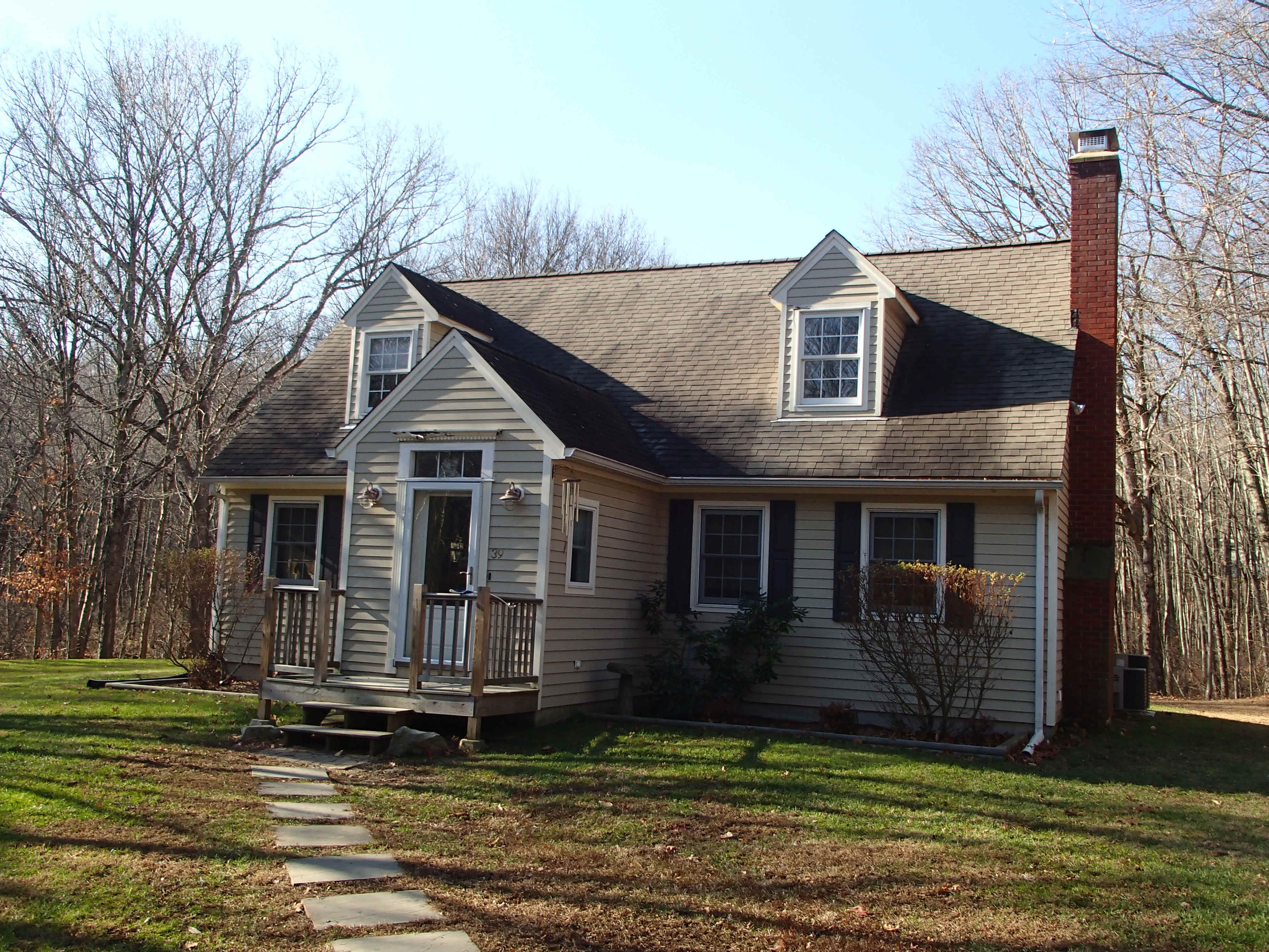
- Style
- Cape Cod
- Year built
- 1986
- Living area
- 1,539 sqft · 112.0 stories
- Exterior
- Clapboard
Recorded sales
Oct 11, 2024
— BROWN MAURA
Bk/Pg 96/575
Oct 11, 2024
— NATIONAL RESIDENTIAL NOMINEE SERVICES INC
Bk/Pg 96/571
Dec 20, 2021
— MANSELL ERIC &
Bk/Pg 0093/0637
Jan 6, 2004
— DELESSIO TODD T
Bk/Pg 0063/0500
Jan 6, 2004
— EMC MORTGAGE CORP
Bk/Pg 0063/0498
More on Millvoe Dr
8 MILLVOE DR
$306,400 · 1.95 ac · Built 1965
9 MILLVOE DR
$595,300 · 2.65 ac · Built 1969
14 MILLVOE DR
$484,800 · 1.9 ac · Built 1996
19 MILLVOE DR
$284,100 · 1.58 ac · Built 1969
20 MILLVOE DR
$304,900 · 1.87 ac · Built 1968
29 MILLVOE DR
$262,500 · 1.95 ac · Built 1971
30 MILLVOE DR
$279,800 · 1.56 ac · Built 1968
36 MILLVOE DR
$230,300 · 1.27 ac · Built 1967